





0
Categorias
Sectores
My account
Ir para Grupo ACRE
Categorias
Sectores
Ir para Grupo ACRE
0
The cart is empty
Continue buying
Log in
Email
*
Password
*
Enter
Switch account
Sign up
Not registered? Create an account now and enjoy all the advantages!
Create an account
Home
Categorias
DRONES
PIX4Dmapper: Software de processamento de imagens
DRONES
PIX4Dmapper: Software de processamento de imagens
Pix4Dmapper, software líder em cartografia e fotogrametria
.
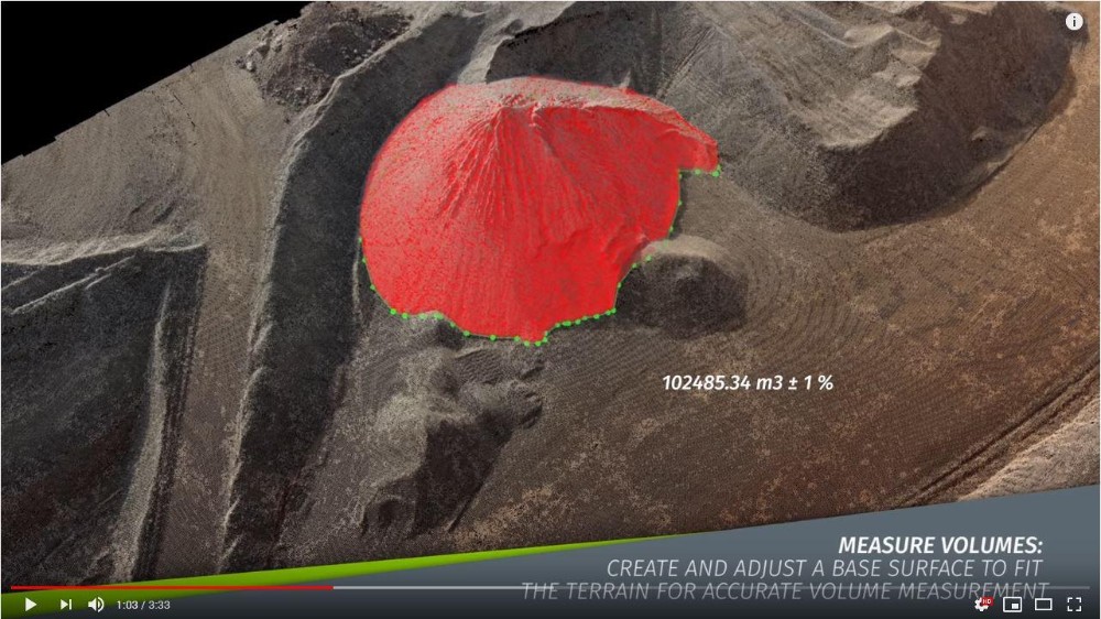
Através das imagens tiradas por ar ou terra, o PIX4Dmapper gera ortomosaicos, DSM e nuvens de pontos. Os módulos rayCloud e Mosaic Editor deste software permitem gerar anotações e aperfeiçoar o acabamento do produto final.
Sectors:
Agricultura de Precisão
Em estoque
290
,00
€
*Preço sem impostos
Notificar-me quando disponível
Comprar
Descarregáveis
Pix4dmapper v4 0
Prazos de entrega
5-30 dias
Aconselhamo-lo na compra do produto
Escreva-nos e aconselhá-lo-emos sobre a compra do seu produto.
Contacte-nos
Ask about the product
We will answer your request shortly
Name
*
Email
*
Your question
*
I have read and accept the
Privacy Policy
and the
Terms of use
Send
Leave a comment
How do you rate this product?
Rate:
5
Name:
*
Comment:
*
I have read and accept the
Privacy Policy
and the
Terms of use
Send a comment
Send this item to your friend
Your name
*
Your email
*
Name of your friend
*
Your friend's email
*
Comment
*
I have read and accept the
Privacy Policy
and the
Terms of use
Send
Send this item to your friend
Your name
*
Your email
*
Name of your friend
*
Your friend's email
*
Comment
*
I have read and accept the
Privacy Policy
and the
Terms of use
Send
Discounts available
Alerta de estoque
Email
*
I have read and accept the
Privacy Policy
and the
Terms of use
Send